As we learn more about climate change and its effects on Earth, we become aware that there is still so much we don’t know about our planet. There are lots of scientists who have dedicated their careers to this cause, but what about engineers, can they help too?
Climate change is a growing concern for people all over the globe. We can see sea levels rising, coral reefs bleaching and more frequent natural disasters, it is clear that we need to do something to slow down or stop climate change. The only way we can do that is to improve our understanding of why it is happening and how it is affecting our planet. One of the best ways to collect data on all these things is using Earth Observation (EO) satellites.
Earth Observation (EO) satellites enable scientists to collect information about Earth’s oceans, forests, weather, and atmosphere.
These satellites enable scientists to collect information about Earth’s oceans, forests, weather, and atmosphere. The real benefit of using satellites is that they have regular access to huge areas of the planet, including places that are sparsely populated or difficult to access like the arctic. EO satellites in low earth orbits re-visit the same areas at a set interval of hours or days allowing them to see patterns in how the Earth changes between seasons and trends across years. This type of consistent and reliable data allows scientists to improve their modelling techniques and better predict how the climate will change in the future, and this then informs the decisions of governments and policymakers.
EO satellites see patterns in how Earth changes between seasons and trends across years, allowing scientists to predict how the climate will change in the future.
Satellites are typically made up of a platform and a payload. The platform provides the propulsion, navigation, power and communication with ground. Then a payload (often called an instrument) carries out a specific mission using a camera or a sensor. For EO satellites each payload can be a new design because there are so many different types of data to collect and areas of the planet to focus on. This means each payload brings new design challenges. This work involves maths and science but also needs creativity and imagination. Being a Systems Engineer means I am involved in the full design process. I help work out how the payload will be made and will operate, deciding on what technologies to use. We must also understand the mission as a whole to make sure our customers get a satellite that meets their needs.
Most of the payloads I have worked on so far are Synthetic Aperture Radars (SAR). SAR payloads feature an antenna which sends microwave pulses towards Earth, and then the antenna receives the reflected signals back from the surface and the data can be processed to make an image.
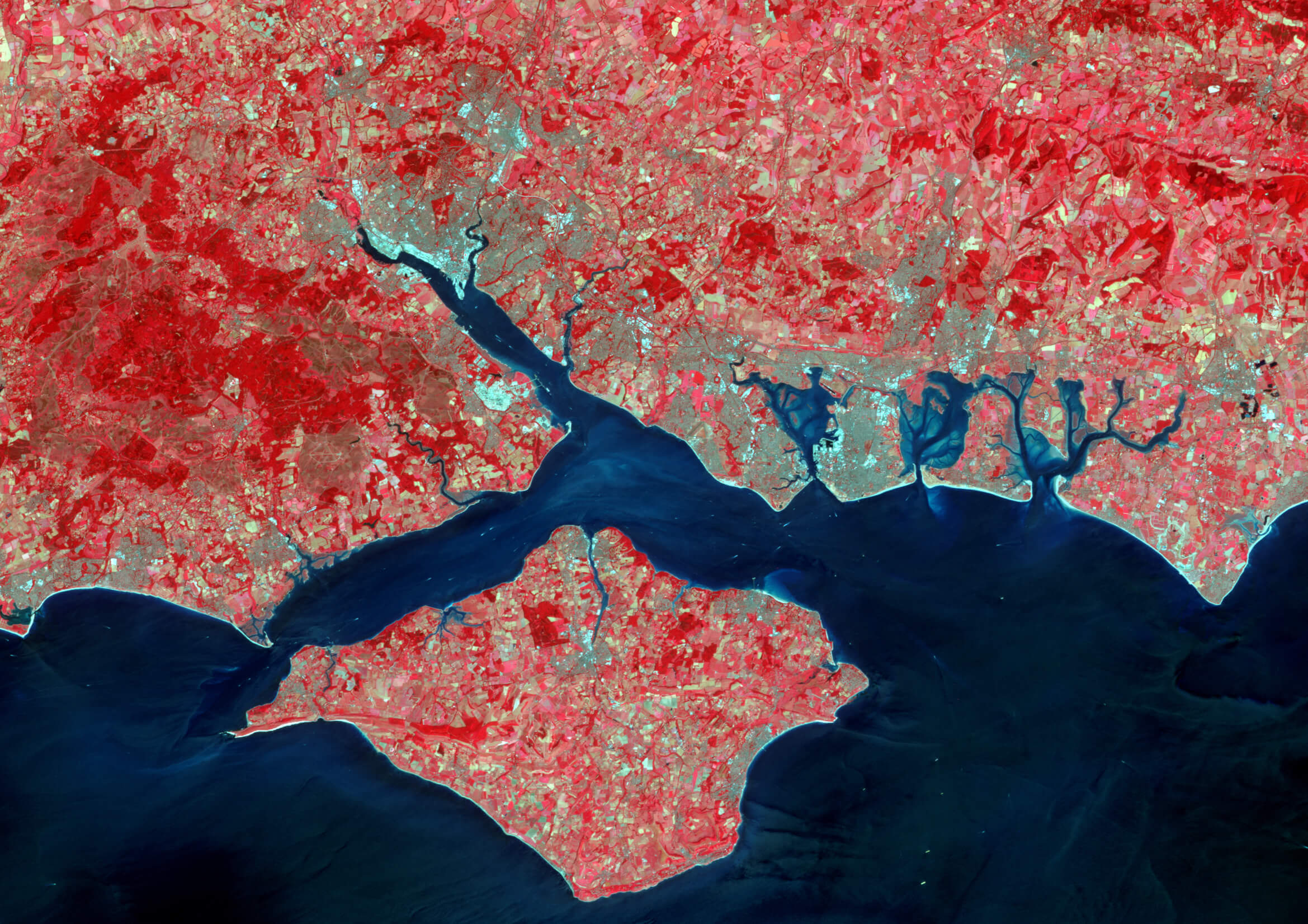
Image: SAR image of Portsmouth, Southampton and the Isle of Wight
It might sound strange but it is not really that different to a digital camera which receives light that has been transmitted from the sun and turns that signal into an image. For each mission a SAR payload is designed to transmit and receive a microwave signal of a certain wavelength. Particular wavelengths are well suited to different things. For example, when looking at a forest, short wavelengths are ideal for high resolution images and looking at the forest canopy, whereas long wavelengths are more effective for measuring forest biomass.

A benefit of SAR (Synthetic Aperture Radars) is that it can take images through clouds and also work in complete darkness.
Because a SAR payload both transmits and receives a signal it is known as an ‘active’ instrument. The benefit of SAR is that it can take images through clouds and can also work in complete darkness, because it doesn’t rely on light from the sun. Since half of Earth is always in darkness this is very useful. SAR can be used for tasks such as providing images during natural disasters where clouds or volcanic dust would block the view of an optical camera. This way governments and aid providers know which areas are worst damaged and where to evacuate people from first. There are several other key uses for SAR where its unique skills can collect climate change data including:
- Looking at polar ice caps as SAR can measure how ice coverage has changed but also look at how thick the ice is. This helps us understand rising sea levels.
- For rainforests it can work out how dense and healthy forests are and how much carbon is stored there (carbon stock). This includes carbon stored in vegetation below the tree canopies because some SAR payloads with longer wavelengths can see through the treetops.
- There is a technique which uses Interferometry with SAR data (InSAR) to measure how the ground in an area has changed height or shape. This can help predict an upcoming earthquakes or volcanic eruption. This edition of Catalyst has a great article on measuring Earthquakes and plate tectonics.
I am currently working on a project with the European Space Agency (ESA) where we are designing a new SAR satellite, called ROSE-L, to join the Copernicus Programme. The Copernicus Programme has a number of EO satellites, called Sentinels, which collect lots of data that is made available for free to scientists, governments and international organisations. The ROSE-L satellite is one of the second-generation Sentinels and will use a longer wavelength SAR payload. It will help with sea ice mapping and the monitoring of glaciers and ice caps as well as collecting InSAR data, map flooding and measuring soil moisture; particularly in areas covered by vegetation. It can also use this data to help with farming, showing when it is best to sow seeds and harvest crops, so we can grow more food to meet the demands of an increasing population and help stop global hunger.
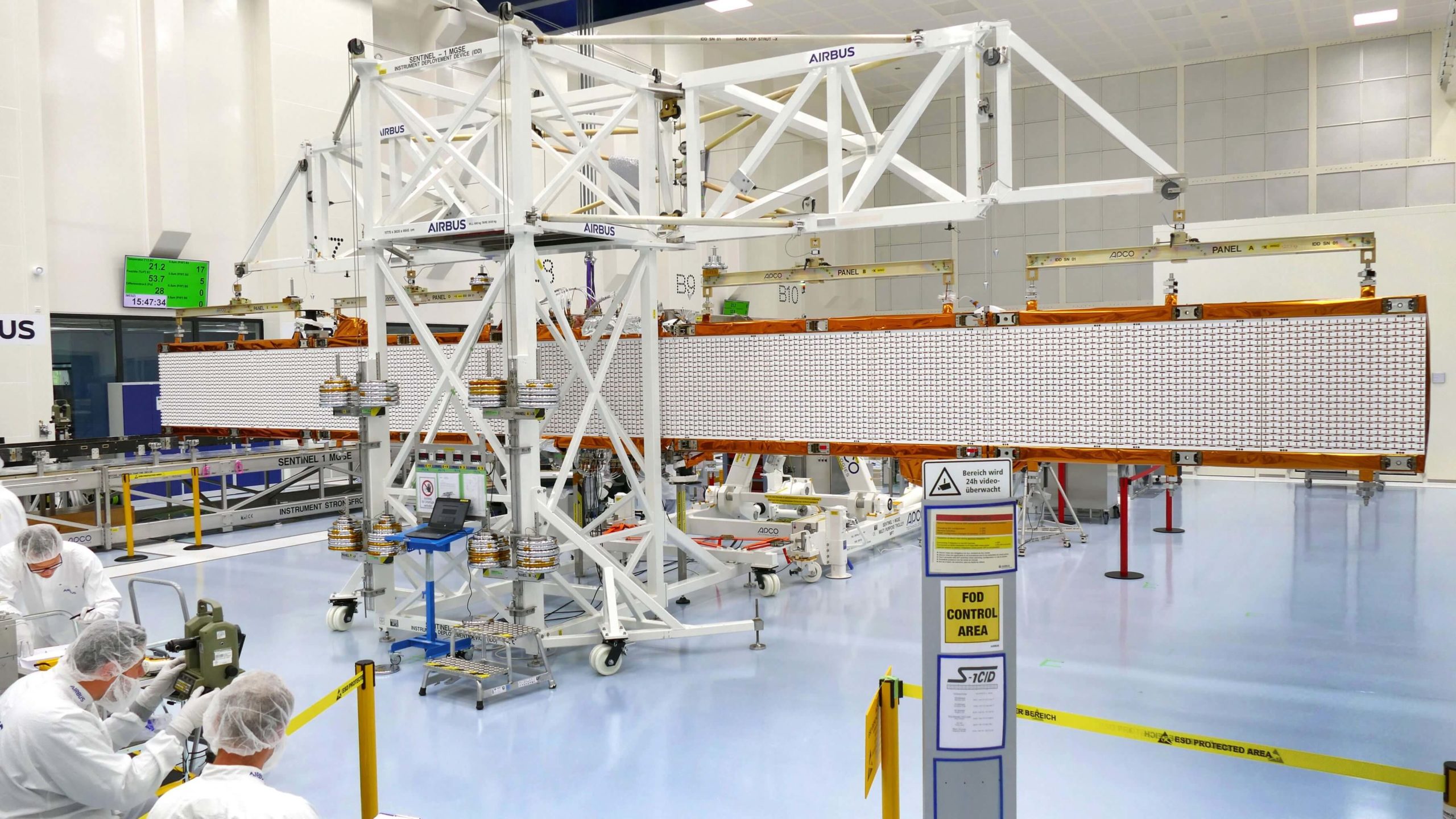
Sentinel-1 antenna deployment testing
Designing a satellite like ROSE-L is a big challenge. The satellite will use a Vega C launcher to get into space and its internal diameter is 3m, by comparison the ROSE-L antenna is a huge 40m2. This means the antenna must be carefully designed to pack down small for launch, deploy once it reaches orbit and then operate in a space environment for many years to keep providing such important scientific data. It takes a huge team of people from all over the world with many different skill sets to make an Earth Observation mission work, but it is very rewarding to know we are all doing our bit to help tackle climate change.
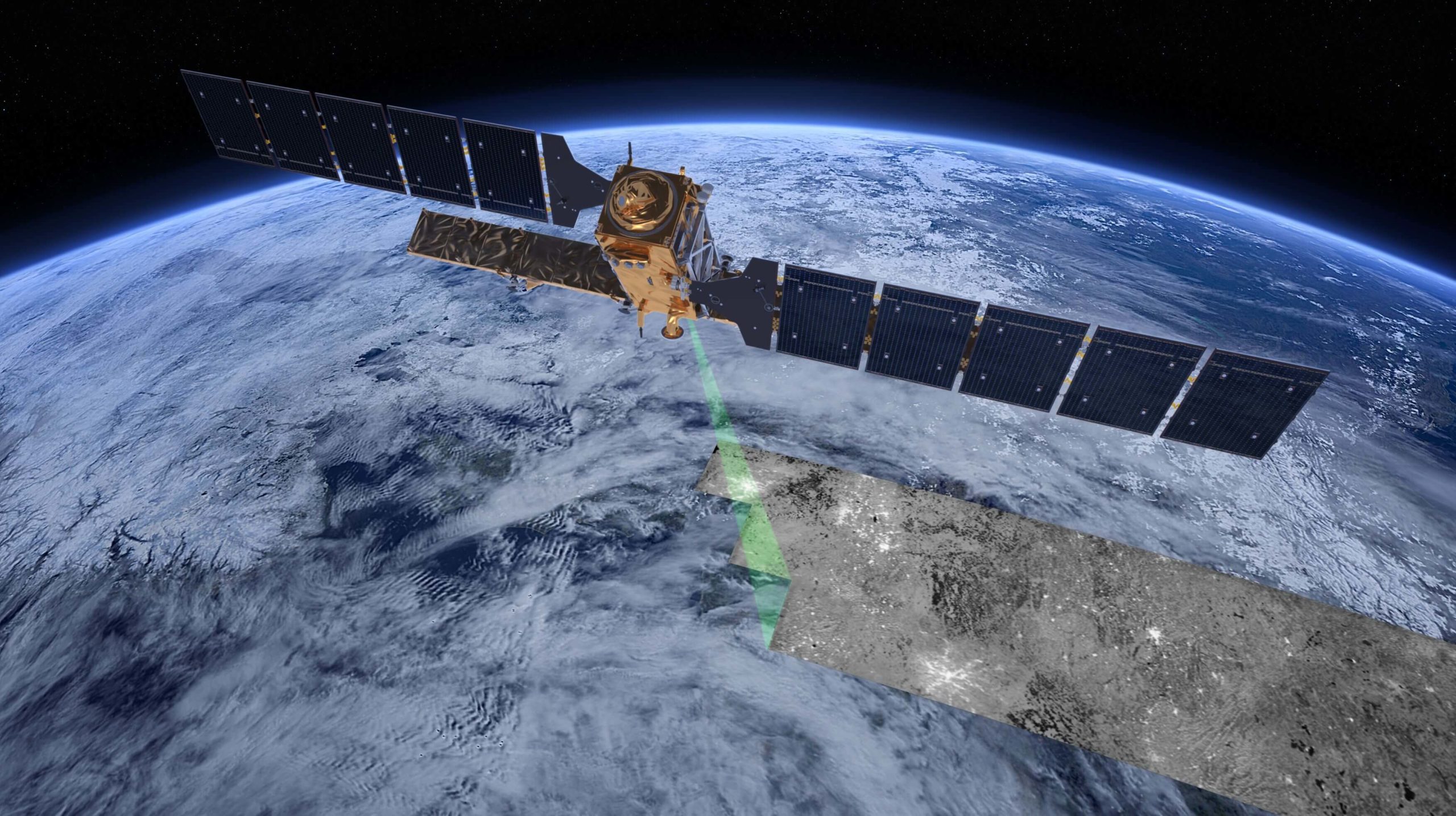
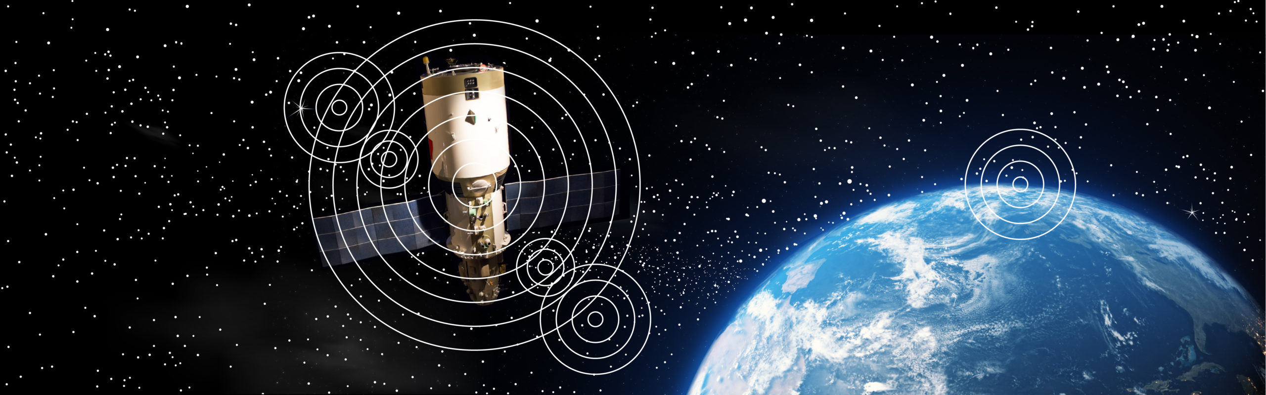
Image: Sentinel-1 in orbit
Harriet Gamble
Instrument Systems Engineer, Earth Observation team at Airbus Defence and Space
Download PDF
If you wish to save, or print, this article please use this pdf version »
Learning resource
We have created learning notes to assist students and educators to further investigate the topics covered in this article. You can download the learning resource here »
